WHERE TO GO IN PUNTA ARENAS AND TIERRA DEL FUEGO
In Tierra del Fuego:
Porvenir:
It is the capital of the province of Tierra del Fuego and has interesting historical attractions and natural beauty around it. One of them is upon arrival to the city, since the access to the city is via a ferry crossing the Estrecho de Magallanes, where you can see dolphins, whales and penguins.
Among the tours that can be done is to visit a king penguin colony, which is located 114 kilometers from Porvenir as well as the Karukinka Park which is on the southern part of the island, where you can do activities like bird watching, especially flamingos and plovers, the Laguna de la Sal, famous for massive amounts of UFO sightings in 1978 and other attractions.
In the center of Porvenir we visit sites of historical significance such as the Fernando Cordero Rusque Museum, with collections of wildlife of Tierra del Fuego and archaeological remains, like a mummy with an undetermined ethnicity named Kela that dates back to the fifteenth century, and the Plaza de Armas with the San Francisco de Sales Church.
Circuito de Oro: (Gold Circuit)
Following the Cordon Baquedano you can tour this historic circuit dating that dates back to the time when gold mining was conducted in the province. It is located approximately 115 kilometers from Porvenir.
Cerro Sombrero: (Sombrero Hill)
Located north of Tierra del Fuego, it is an old oil field, where you can find ancient structures that correspond to its removal, since the first oil well in the region was discovered here.
Next to the Cerro Sombrero (Sombrero Hill) you find Side River, with ideal conditions for salmon fishing.
Besides this, it features 15 kilometers of inter-oceanic beaches, that is to say water found at the junction of the Atlantic and Pacific oceans and are the habitat of marine fauna.
Parque Nacional Alberto de Agostini: (Alberto de Agostini National Park)
It has over 1,400 acres and is the third largest national park in Chile. It consists of the archipelago of the islands south of the Estrecho de Magallanes and west of the Navarino Island .
Its main attraction is the Cordillera of Darwin, which runs through its territory with glaciers and ice fields such as the Pia, Garibaldi and Marinelli Glaciers, among others. It also has beautiful exuberant green forests that are located in the foothills of the Andes, with species such as canelo, beech and coigues, plus southernmost flora such as fungi, lichens and mosses.
It is the habitat of marine fauna such as albatrosses, petrels and cormorants as well as elephant seals, otters and nutria.
A curiosity of the Alberto Agostini Park is that it is found printed on the back of the 10,000 Chilean pesos bills.
Glaciar Marinelli:
It is the largest in the area and has stunning ice walls that are over 40 feet high. It is located in Ainsworth Bay and is part of the Cordillera of Darwin.
Lago Blanco:
It is located 218 kilometers southeast of Porvenir and offers a free camping area for those who want to stay at its shores. You can take excursions like hiking up Cerro Cuchillo that has 800 meters of altitude, sport fishing for rainbow and brown trout and observe beavers and their dams.
Cordillera de Darwin:
This ice covered mountain is located inside the Alberto De Agostini National Park , southeast of Tierra del Fuego. It corresponds to the southern end of the Cordillera de los Andes. It has the highest peaks of the southern area, the largest being Shipton with more than 2400 meters of altitude.
Bahía Lomas:
This wetland allows birdwatching of native wildlife in the area and is located north of Tierra del Fuego. Some species that can be spotted are the beach plover, straight bill curlew, the plover of Magallanes and the Chilean flamingo. It is also known as a whale beaching site, such as black orca and the long-finned pilot whale.
Cabo de Hornos:
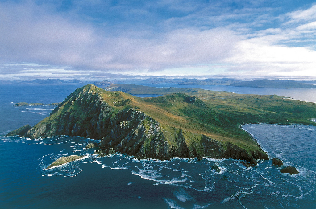
Discovered in 1616 by Dutch owners in search of a path connection between the Atlantic and Pacific, is considered the southernmost part of South America. It is a dangerous area for navigation, with strong waves and winds, plus the presence of icebergs. There is a sculpture of an albatross in flight in tribute to the sailors who lost their lives trying to get around it.
Circuito Vicuña en el Canal de Beagle:
In this area you can find snook and mackerel with your hands, as they remain on the shore at low tide, in addition to hiking between virgin forests, stunning glaciers and hidden lakes.
Circuito Histórico Bahía Inútil:
It lies south of Porvenir, crossing the Santa Maria Lake which corresponds to a waterfowl reserve, habitat of black-necked swans, flamingos and coots.
In Punta Arenas:
Plaza de Armas Benjamín Muñoz Gamero:
It is located in the downtown area of the city and in it we can see the Monumento al Ovejero (Shepherd Memorial), the sculpture of Hernando de Magallanes which stands 9 meters high together with an indigenous ona a tehuelche and a mermaid. A curiosity of the sculpture is the belief of kissing the finger of the Ona Indian for good luck.
Museo del Recuerdo:
This outdoor museum allows you to see machinery, tools and buildings from the era of the late nineteenth and early twentieth century at the time of Croatian immigration.
Museo Regional Salesiano Maggiorino Borgatello:
It is a museum that was inaugurated in the nineteenth century, with archaeological collections, samples of flora and fauna and historical documents.
Zona Franca:
It is the commerce center and it is located north of Punta Arenas and is famous because it allows you to buy tax free products such as perfumes, electronics, clothing and even automobiles.
Monumento al Inmigrante Croata:
This sculpture was built in 1970 in honor of the Croatian immigrants who arrived during the second half of the nineteenth century. These settlers developed many of the activities in the area such as masonry and navigation and most of the inhabitants of Punta Arenas are descendants of these early families.
Cementerio de Punta Arenas:
Opened in 1894 and is highlighted because of its beautiful English styles, with cypresses, beautiful gardens and luxurious mausoleums built by the wealthy families of the early twentieth century.
Reserva Nacional Magallanes:
Also known as Rio de las Minas or Japanese Park, was founded in 1932 and has an area of over 20 thousand acres. It possesses beautiful Nothofagus forests that provide habitat for native fauna such as guanacos, ducks, flamingos and condors. It is located 7.5 kilometers west of Punta Arenas.
Estancia San Gregorio:
The "estancia", which opened in 1876 , was the largest in Chile, with a beautiful French-style house, a train and a dock for transporting wool. It is located 124 kilometers north of Punta Arenas, on the west shore of the Estrecho de Magallanes.
Club Andino:
This ski resort is located in Cerro Mirador, 5 miles west of Punta Arenas. It has 14 ski slopes that have descents that overlook the Estrecho de Magallanes.
During the summer its facilities are used for hiking and mountain biking.
Reserva Nacional Laguna Parrillar:
It is located 50 kilometers south of Punta Arenas with an area of over 18 thousand acres. It features a lake surrounded by a beech forest.
Fuerte Bulnes:
It was built to protect the sovereignty of Chile at the southernmost end. It is located 60 kilometers south of Punta Arenas and has beautiful natural areas around it.
Pinguineras Seno Otway:
This area is located 65 kilometers northwest of Punta Arenas, in the Seno Otway, every year Magellanic penguins come to nest here so habits and the growth of their seeds can be observed.
Monumento Nacional Los Pinguinos:
In Santa Marta and Magdalena Islands we find this Natural Reserve where another important penguin colony can be found, where there are over 60,000 birds nesting in this area and are also shared with other species such as cormorants and sea lions. To get from Punta Arenas you must travel 65 kilometers by boat, a journey that takes about 2 ½ hours.
Isla Carlos III:
Located in the Estrecho de Magallanes and 190 kilometers fromPunta Arenas, is one of the best places to observe humpback whales that swim from the coast of Colombia to the Antarctic. They are characterized by their acrobatic leaps that provide a wonderful show.
Also, in this area of confluence of the Atlantic and Pacific Ocean other species can be seen such as minke whales, sea lions, elephant seals, Magellanic penguins, albatrosses, Chilean skua and other inhabitants of these icy spots.
In the Isla Carlos III (Carlos the Third Island) the Francisco Coloane Marine Park is located and inaugurated in 2003, declaring the area as a Protected Area. In its 67 thousand acres we can also find ñirres, coigues, and canelo forests as well as peat vegetation, consisting of small ferns and mosses.
The park seeks to preserve the life of its inhabitants and take care of their ecosystem composed of beaches, coasts, glaciers and sea. In some areas you can do recreational activities such as hiking and kayaking.


